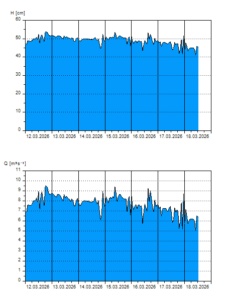
 |
| |
H
[cm]
|
Q
[m3.s-1]
|
QN
|
|
23.09.2026 10:40
| 24 |
1,772
|
|
|
23.09.2026 10:30
| 24 |
1,787
|
|
|
23.09.2026 10:20
| 24 |
1,813
|
|
|
23.09.2026 10:10
| 24 |
1,832
|
|
|
23.09.2026 10:00
| 24 |
1,833
|
|
|
23.09.2026 09:00
| 25 |
1,875
|
|
|
23.09.2026 08:00
| 24 |
1,868
|
|
|
23.09.2026 07:00
| 25 |
1,878
|
|
|
23.09.2026 06:00
| 24 |
1,865
|
|
|
23.09.2026 05:00
| 25 |
1,901
|
|
|
23.09.2026 04:00
| 25 |
1,894
|
|
|
23.09.2026 03:00
| 25 |
1,876
|
|
|
23.09.2026 02:00
| 25 |
1,916
|
|
|
23.09.2026 01:00
| 25 |
1,917
|
|
|
23.09.2026 00:00
| 25 |
1,979
|
|
|
22.09.2026 23:00
| 25 |
1,934
|
|
|
22.09.2026 22:00
| 24 |
1,871
|
|
|
22.09.2026 21:00
| 25 |
1,962
|
|
|
22.09.2026 20:00
| 25 |
1,906
|
|
|
22.09.2026 19:00
| 25 |
1,889
|
|
|
22.09.2026 18:00
| 25 |
1,896
|
|
|
22.09.2026 17:00
| 26 |
2,149
|
|
|
22.09.2026 16:00
| 25 |
1,904
|
|
|
22.09.2026 15:00
| 24 |
1,785
|
|
|
22.09.2026 14:00
| 24 |
1,842
|
|
|
22.09.2026 13:00
| 24 |
1,835
|
|
|
22.09.2026 12:00
| 24 |
1,865
|
|
|
22.09.2026 11:00
| 24 |
1,871
|
|
|
22.09.2026 07:00
| 25 |
1,915
|
|
|
21.09.2026 07:00
| 27 |
2,244
|
|
|
20.09.2026 07:00
| 21 |
1,449
|
|
|
19.09.2026 07:00
| 21 |
1,511
|
|
|
18.09.2026 07:00
| 22 |
1,578
|
|
|
17.09.2026 07:00
| 24 |
1,821
|
|
H — water level
Q — Discharge
QN — QN |