 |
| |
H
[cm]
|
Q
[m3.s-1]
|
QN
|
|
03.10.2026 23:50
| 92 |
0,579
|
|
|
03.10.2026 23:40
| 92 |
0,580
|
|
|
03.10.2026 22:00
| 92 |
0,580
|
|
|
03.10.2026 21:00
| 92 |
0,587
|
|
|
03.10.2026 20:00
| 92 |
0,597
|
|
|
03.10.2026 19:00
| 92 |
0,595
|
|
|
03.10.2026 18:00
| 92 |
0,591
|
|
|
03.10.2026 17:00
| 92 |
0,599
|
|
|
03.10.2026 16:00
| 93 |
0,617
|
|
|
03.10.2026 15:00
| 95 |
0,798
|
|
|
03.10.2026 14:00
| 92 |
0,594
|
|
|
03.10.2026 13:00
| 92 |
0,592
|
|
|
03.10.2026 12:00
| 92 |
0,593
|
|
|
03.10.2026 11:00
| 92 |
0,590
|
|
|
03.10.2026 10:00
| 92 |
0,595
|
|
|
03.10.2026 09:00
| 92 |
0,599
|
|
|
03.10.2026 08:00
| 92 |
0,587
|
|
|
03.10.2026 07:00
| 92 |
0,579
|
|
|
03.10.2026 06:00
| 92 |
0,588
|
|
|
03.10.2026 05:00
| 92 |
0,586
|
|
|
03.10.2026 04:00
| 92 |
0,597
|
|
|
03.10.2026 03:00
| 92 |
0,598
|
|
|
02.10.2026 07:00
| 92 |
0,603
|
|
|
01.10.2026 07:00
| 93 |
0,618
|
|
|
30.09.2026 07:00
| 93 |
0,637
|
|
|
29.09.2026 07:00
| 93 |
0,680
|
|
|
28.09.2026 07:00
| 94 |
0,714
|
|
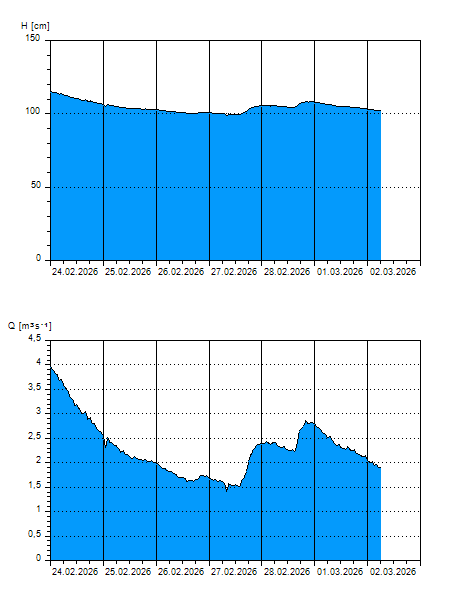
H — water level
Q — Discharge
QN — QN |